
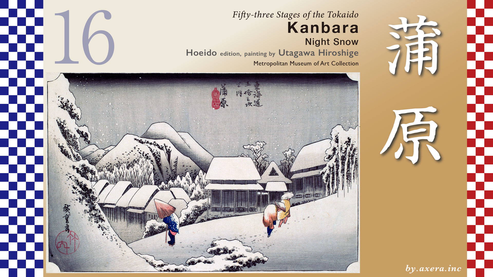
This painting depicts people walking with umbrellas on a snow-covered mountain road.
Kambara-juku is located about 11 km from Yoshiwara-juku. First, look at the map and find the Fuji River.
The Tokaido splits into three roads at Yoshiwara-juku: the Tokaido, the Nakamichi Okan that runs from Fujinomiya to Kofu, and the Jūriki-Michi that runs to Gotemba.
The Tokaido further splits into the Kami-kaido, which crosses the Fuji River at Matsuoka, and the Shimo-kaido, which crosses the Fuji River near the river mouth.
The Tokaido, Kami-kaido crossed Shiken Bridge and left Yoshiwara-juku behind.
Crossing the Urui River, you will find Moto-Ichiba, which is resting place between two jukus. This place is famous for its white sake, and it is also the place that Hiroshige painted in his Gosho edition of Yoshiwara-juku.
Further on, there is a small bridge over the Fuji-Hayakawa irrigation canal with the remains of a signpost intersection, which was also used as a place for posting official notices.
The Tokaido continues onward, passing Yugi Station on the JR Minobu Line. There, the road splits into two.
The Fuji River ahead is known throughout the land for its rapid currents and high water volume, so a ferry was used to cross it. There were three landing stages: Kami-funasue, Naka-hunasue, and Shimo-funasue, located from north to south, which were used depending on the water volume and river conditions.
In most cases, the area around the current Suijin Shrine, which is Shimo-funasue, was used, and that area was also called Semba.
On the opposite shore is the Iwabuchi , and from there you can see that the Sui-jinja Shrine is surrounded by a lush forest.
After crossing the Fuji River by boat, the Tokaido climbs a steep slope and heads south.
There was a Ichiri-zuka at the sharp curve in Iwabuchi.
Continuing south, you will pass under the Tomei Expressway and come to the temple sign for Jisso-in Temple. Turn left and continue south.
The Tokaido now runs parallel to the Tomei Expressway, and eventually crosses the expressway via a bridge.
The road turns sharply to the right, and beyond that is Higashi-kido, which marks the beginning of Kambara-juku.
Now, take a look at this map of the Tokaido from the Meiji period, created by the Geographical Survey Institute.
The area between Yoshiwara-juku and Kambara-juku was prone to many disasters.
This area is mostly made up of the alluvial fan of the Fuji River, which has changed its course many times since ancient times, flowing into the sea after merging with the Urui River to the east.
Subsequent sedimentation and subsidence and uplift caused by earthquakes caused the Fuji River to flow mainly to the west. This is a rough outline of the current normal course of the Fuji River.
The early Tokaido ran from the east side of what is now Yoshiwara Station, called Moto-yoshiwara, along the coast, joined the Shimo-Kaido at Kawanari-jima, and headed toward Kambara-juku. At that time, Kambara-juku was located a little closer to the sea than it is now, south of JR Shin-Kambara Station.
This former Yoshiwara-juku suffered devastating damage from a high tide in 1639, so Yoshiwara-juku, itself was relocated to Naka-yoshiwara to prevent a recurrence.
However, in 1680, Naka-yoshiwara was again devastated by high tides and relocated to the current Yoshihara Honcho area inland as Yoshiwara-juku. Here, we switch to an aerial view of the map.
Later, in August 1699, Kambara-juku also suffered devastating damage from a typhoon and a spring tide, resulting in the loss of 60 people, including residents and travelers. The following year, Kambara-juku was relocated to its current location. However, unlike Yoshiwara-juku, Kambara-juku was only moved slightly closer to the mountains.
Here, we will use a base map that clearly shows the current elevation differences. You can see how low-lying the mouth of the Fuji River is. It is also clear why disasters occurred so frequently.
The other is the battle against the Fuji River.
Please take a look at the entire Fuji River on Wikipedia’s wide-area map. The Fuji River originates in the northern part of the Japan Southern Alps, on the border between Yamanashi and Nagano Prefectures, and is a huge river with a main stream length of 128 km and a basin area of 3,990 square kilometers.
I colored the watershed area in blue. You can see that it is about the same size as Tokyo. Rain that falls in this vast watershed area flows down to the alluvial fan downstream after passing through Mt. Iwamoto.
A grand river improvement plan called Karigane Tsutsumi was devised to mitigate the damage caused by flooding. The remains of this plan are shown in red lines.
These are the remains of embankments built by our ancestors over a period of more than 50 years from 1674 to prevent the waters of the Fuji River from overflowing to the east. It is said that these embankments came to be called Karigane Tsutsumi because they resemble a flock of geese flying in formation.
This is a Google map viewed from the east, with the area surrounded by the Karigane embankment colored light blue. The idea was to use this light blue area to collect water from the river. During the construction, a huge rock formation was found underground Sui-jinja shrine, which is now a lush forest in the photo, and this was used as the foundation for the embankment.
This Sui-jinja shrine is located at the southern end of Karigane embankment, and the Tokaido Fuji River crossing mainly departed and arrived from here. For clarity, I have marked the Tokaido in orange.
After the completion of Karigane embankment, the left bank, which was no longer subject to flooding, and the Kajima Plain in the foreground of the photo underwent new land development, and its appearance came to be praised as “Kajima 5,000 koku.” This means that the land is so fertile that it can produce 5,000 koku of rice.
However, the right bank areas of Iwabuchi, Nakano-go, and Kambara, which had previously been spared from damage, began to suffer frequent flood damage. In the end, the Fuji River remained a wild and unpredictable river until modern times, when flood control measures such as new embankments and water diversion plans were implemented to mitigate flooding.
According to legend, construction of the Karigane embankment did not progress very well, so human sacrifices were used to push the project forward. In fact, a stone tower commemorating the human sacrifices has been erected at Goshō Shrine, located at the eastern end of the Karigane embankment, as if to confirm this legend. It is hard to believe, but this is the hidden side of public works projects in the Edo period. It also means that the Tokaido existed at the expense of human lives.
Now, let’s take a closer look at Hiroshige’s painting.
A resident is walking down a slope lined with houses, holding an umbrella close to his body, while two travelers are climbing the slope with bamboo umbrellas. It seems as if they have started moving, taking advantage of the light snowfall. Behind them, mountains are depicted in two layers, and snow has accumulated on the roofs of the houses, creating a quiet night scene. The nearly monochromatic composition evokes a sense of stillness and silence, as if the space were devoid of sound. This work is widely regarded as a masterpiece within the series.
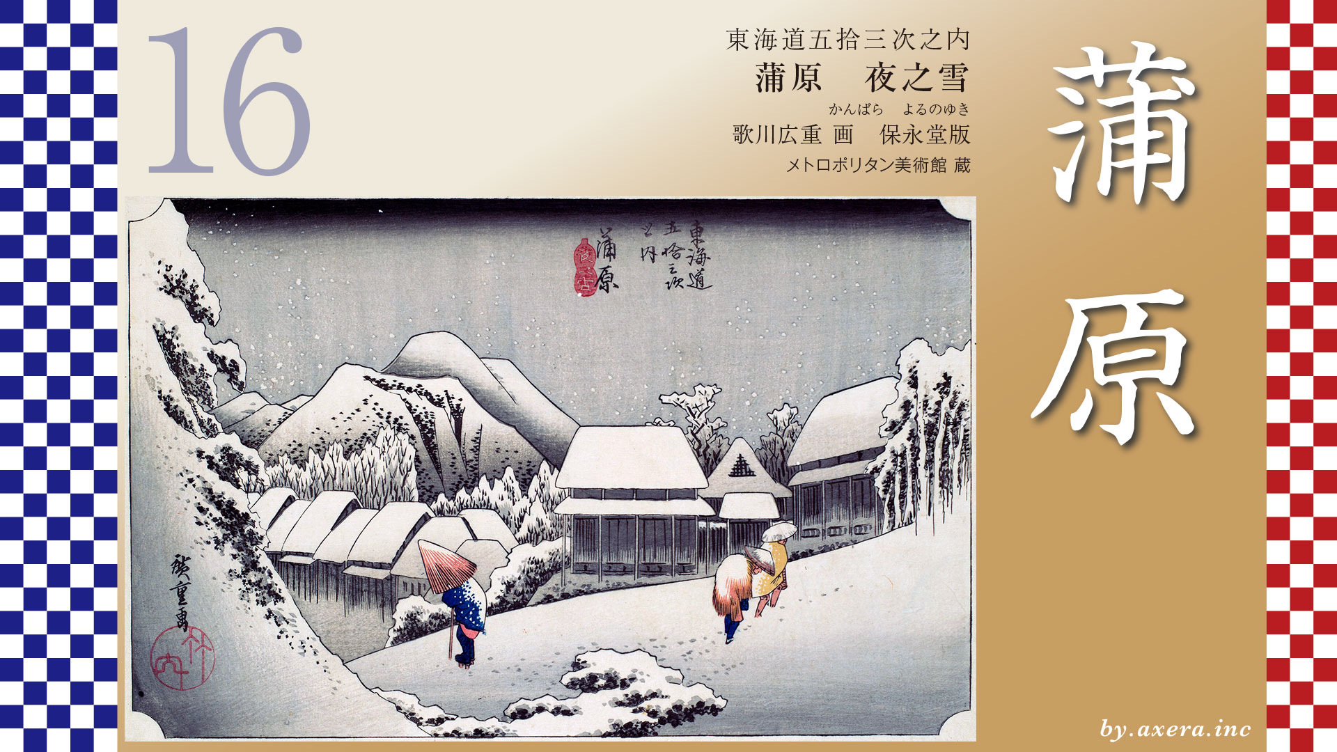
Actually, what I thought was the first print and chose to feature this time may have been a second print, judging from the condition of the woodblock. Please take a look at the painting from the Museum of Fine Arts, Boston, which I initially thought was a second print. Well, what do you think?
In the other edition, the gradient of the background behind them is reversed, emphasizing the darkness of the night and the whiteness of the snow. Personally, I prefer this one.
The Reisho edition depicts travelers enjoying a leisurely boat trip while viewing Mount Fuji from the Iwabuchi side.
The Gosho edition depicts two Komuso monks gazing at Mt. Fuji from a slight elevation on the Iwabuchi side across the Fuji River.
The poem editin depicts a traveler getting off a ferry boat, climbing a steep slope at the base of a cliff, and looking back at Mt. Fuji.
Hokusai depicts fishermen using dragnets on the sandy beach of Kambara. In fact, the beach at Kambara was known as Fukiage Beach, and was considered to be one of the most scenic spots in Mount Fuji, along with Miho no Matsubara.
This is the view of Mt. Fuji and Mt. Aitaka from the embankment beyond the current Fukiage Beach. Unfortunately, on this day, the top of Mt. Fuji was hidden by clouds, but in the Edo period, when the banks of the Fuji River were largely unimproved, the view of Mt. Fuji must have been spectacular.
Now, even today, no one knows exactly where this painting was created. It depicts a snowy landscape in a warmer climate, and experts have various opinions about it. All we can say for sure is that there are mountains in the background, and that it shows a place where you can see steep slopes like mountain roads leading down to a row of houses.
This is a street view of Kambara-juku from the sea side on Applemap. The Tokaido is marked in orange. The Tokaido, which descends from the mountainside, gradually becomes less steep, and tKambara-juku is located on almost flat ground, so the only place that matches the conditions depicted by Hiroshige is within the red dotted line.
The most likely location among them is the slope near Kōrenji Temple, just before Kambara-juku. However, there are no mountains rising up on the left side here.
Or, this place a little further down is the second candidate, but there are no mountains on the left side, and the mountains on the right side are not high either.
Once you enter Kambara-juku, you can hardly see the mountains anymore. Also, there are no steep slopes, so it’s not a candidate.
Kambara-juku, which was bustling with activity during the Fuji River flood season, still retains its charming townscape with remnants of the Edo period, such as the Honjin and inn sites. Kambara-juku is considered the masterpiece of Hiroshige’s series, so perhaps the location where it was painted is irrelevant.
This is Kambara-juku, where travelers from Edo took a long detour along a road that had been ravaged by natural disasters. I would like to think that it was a place where travelers could take a breather, regardless of whether it was sunny or snowing. Perhaps it was even more appreciated than the spectacular view from Fukiage Beach.
I looked at the area beyond Kambara-juku on Google Maps. Beyond this point, the mountains on the right gradually approach the sea, and after passing Yui, the Tokaido is blocked from continuing on to Satta Pass.
コメント