
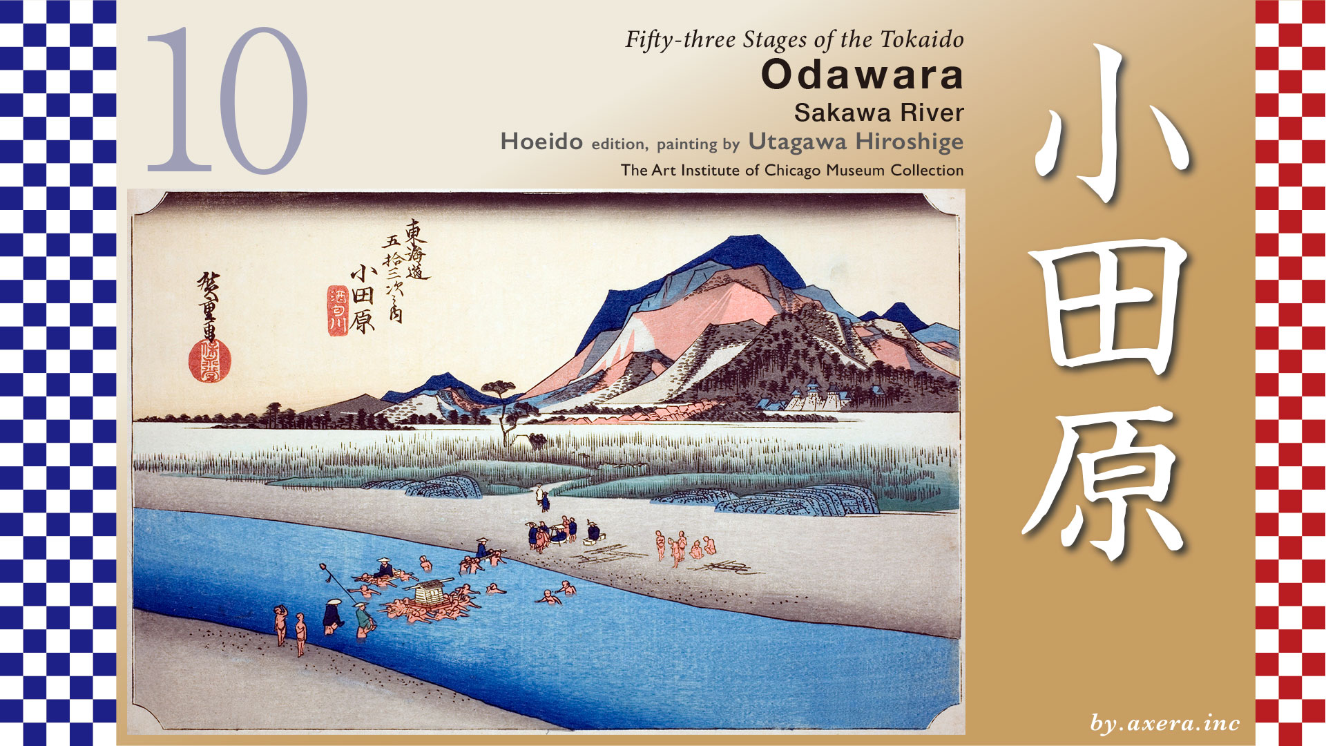
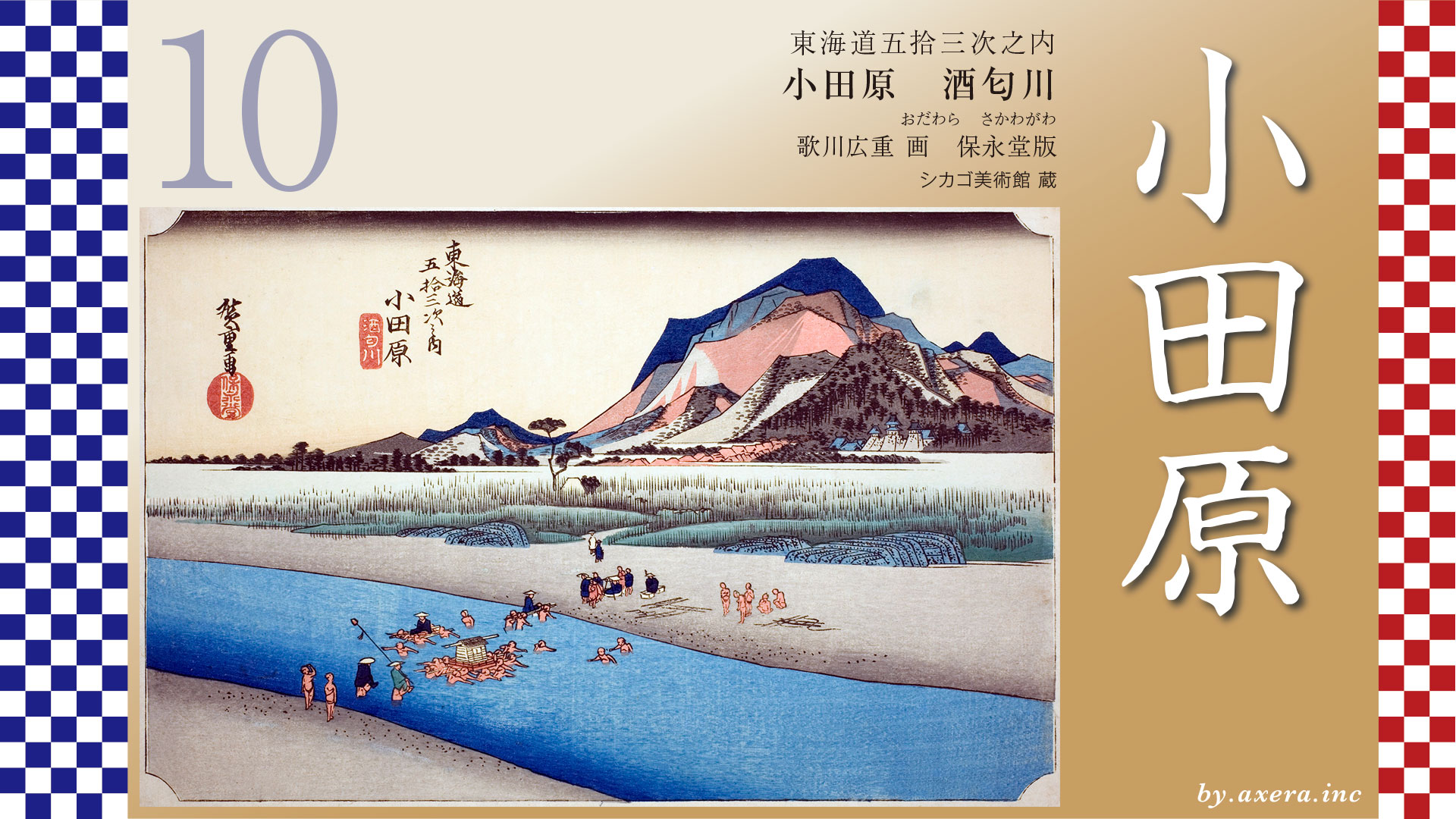
This painting depicts the Kachiwatashi (human powered crossing) of the Sakawa River, which flows in front of Odawara-juku.
From October to February, when the river runs dry, the river is crossed by an earthen bridge, but from March to September, when the water volume increases, the river was crossed by Kawagoshi-ninsoku walkers.
The distance from Oiso-juku to Odawara-juku was nearly 16 km.
The Tokaido leaves Oiso-juku and splits off to the right from Shiroyama Park, just before the descent through the pine trees, but it rejoins Route 1 when it crosses the river. On the seaward side of Shiroyama Park is the residence of Shigeru Yoshida, who served as prime minister after the war.
Beyond that point, climbing the Ninomiya slope, the road splits off to the right once, rejoins Route 1, and then splits off to the left once more before Oshikiri-zaka slope. At this parting, there is a mound of trees and this area is called Umezawa-no Tateda, where travelers could take a rest at a tea stall.
The Tokaido crosses the Nakamura River and climbs up and down a gentle slope to reach Kurumazaka. This is a famous place where Ota Dokan and Minamoto no Sanetomo left poems, and the scenery opens up after passing this point. The view past this point opens up, and in front of you you can still see Sagami Bay and the Izu Peninsula in the distance. It is easy to imagine the admiration of the travelers who came here.
This is the current view, but in the Edo period, there was no Seisho Bypass in front of the view, so the scenery must have been very nice.
The Tokaido, which continues on its present course, comes to the Sakawa River, which is now crossed by the Sakawa Bridge, but in the Edo period, people used to use the crossed by Kawagoshi-ninsoku walkers, a little north of this bridge during the summer months.
Crossing the Sakawa River and then the Sanno River, we come to Edoguchi Mitsuke, which is the beginning of Odawara-juku. A little further past there, at Shinshku, The Tokaido turns left, passing through what we now call Kamaboko-dori street.
The area where Kamaboko-dori Street meets Route 1 again is the location of the Honjin and the center of Odawara-juku. The official area of Odawara-juku extended beyond this point to the Shinkansen guard. Odawara-juku was quite large, with a population of approximately 5,400, 1,500 private houses, 100 inns, and four each of the main and side daimyo’s inns.
This is the present Odawara Castle. The castle tower was rebuilt in 1960 in reinforced concrete. Inside the castle tower is a museum.
Please look at the map of GSI. The Tokaido is depicted on this map.
Odawara, which was ruled by the Hojo clan, was attacked by Shingen Takeda at Odawara Castle in 1569, so the town was fortified with a moat around the outside of the town, making it impregnable. No wonder the town was so large. I have tried to reproduce the castle structure using the Bunkyu-ezu, illustrated map.
However, in 1590, Toyotomi Hideyoshi attacked Odawara as the finishing touch to unify the country, and after three months of siege and food deprivation, the castle was opened almost without bloodshed. Odawara was then taken over by Tokugawa Ieyasu. In fact, Ieyasu, who had chosen Edo Castle as his residence, placed his inner circle, the Okubo clan, here and reduced the size of the castle. In fact, Ieyasu, who had chosen Edo Castle as his residence, placed his inner circle, the Okubo clan, in Odawara and reduced the size of the castle.
This is a photograph of the model of Odawara Castle on display at the Odawara Castle Museum, taken from the east. The Tokaido ran along the seaward, or left, side of this model. Odawara Castle was visible from this direction when viewed from the direction of the Sakawa River.
Let’s take a closer look at Hiroshige’s painting. He depicts here various ways of crossing the river. In the foreground, on the left, two people are being carried on shoulders in the cheapest way. The two pairs of men in dark blue robes at the back of the picture are carrying one person on a palanquin stand, which is a palanquin stand with no railings. The common people usually crossed the river in this manner. Daimyo who were in the middle of the river would have their palanquins carried on a palanquin dais, and 16 to 24 people would carry them across the river. The masters of wealthy families and daughters of samurai families also carried palanquins on their palanquin carriages. You can see a group of seven people waiting on the other side of the river.
If you look closely, you can see various scenes from across the river on the other side, including a scattered wheeled palanquin stand and naked people waiting for customers. The material depicted at the far end of the riverbank is a “snake basket,” which is used to protect the riverbank when the water level rises. Beyond the reeds growing on the riverbank is Odawara juku, and to its right, the blue roof depicts Odawara Castle.
Odawara Castle was ruled by the Okubo clan during the Edo period, who were also responsible for managing the Hakone barrier. The colorful mountains behind the castle are Hakone. To its left are the mountains of the Izu Peninsula beyond the Jukkoku Pass.
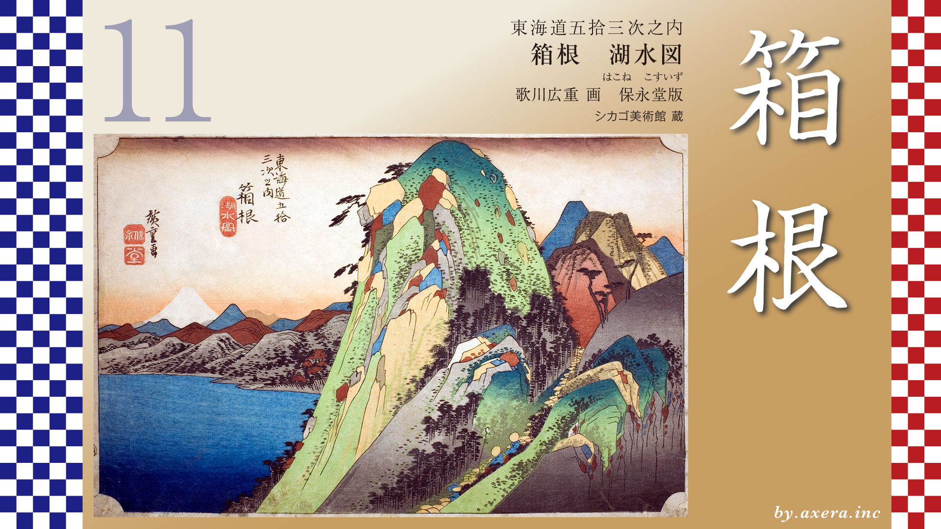
There are many other edition in this Odawara painting by Hiroshige. Please take a look at just one of them.
The colorful mountains in the background are now drawn in the normal way, and the composition of the river crossing members is slightly different.
The Reisho edition focuses on the movement of the figures and shows various Kawakoshi ninsoku facial expressions. The cheerful expression of the ninsoku is interesting. The pine forest on the other side of the river is also emphasized considerably.
The Gosho edition depicts a view over the river, not centered on the human foot, but as a whole landscape. The red surface of the mountains is probably an image of autumn. The Tokaido in the foreground on the right is depicted in a very splendid manner.
The Poem edition depicts the area around what is now Kamaboko-dori Street, after entering Odawara-juku. It depicts a traveler walking along a beautiful row of pine trees and a local fisherman pulling up a seine net.
Finally, please also see Hokusai’s 53 Stages. It depicts a woman selling Uiro, which was sold as medicine at the time, the woman who stopped her, and Odawara Castle. This is a better introduction to Odawara.
I also included a picture of “Uiro,” which is actually still sold today. It is interesting that it is written “sweets” now. It is said that this Uiro with brown sugar is the original Uiro.
The Uiro store still exists today, and its castle-like building stands along National Route 1, which is surprising at first sight.
There is a photo of the Sakawa Bridge taken in 1918. There was a human powered crossing the Sakawa River a little to the right of the bridge.
I actually tried to go here.
This is a picture taken from the bank of the Sakawa River. Now Odawara Castle is not even visible. Looking at this, you can see that Hiroshige’s painting emphasizes the mountains much more than the Sakawa River.
Please also see the Google MAP street view from a slightly elevated perspective. You cannot see Odawara Castle, but you can see the Izu Peninsula and the Hakone area. The Tokaido is covered with orange. Odawara-juku was a very prosperous post station in front of the Hakone Pass, and you can see that another business, “river crossing,” flourished on the Sakaogawa River in front of the Odawara-juku.
Now the Sakawa River, down to its lowest point, has a bridge over the Seisho Bypass, which, whether good or bad, allows things and people to pass through at great speed.
From the ferry on the Sakawa River, if we were lucky, we could see such a view of Mt.Fuji from the shadows of the mountains.
Please also see Google MAP Street View for a slightly wider area. Odawara was also the first castle town that one encountered after leaving Edo. Odawara Castle, which could be heard from the heavens, was a landmark visible from afar even in those days, and travelers on The Tokaido must have been very happy to see it. Travelers from Edo were also impressed by the expanse of the sea, the mountains of Izu beyond, and Hakone connected from there.
I have tried to highlight such Odawara Castle a little.
This is the opposite view, looking toward the Sakawa River from Odawara Castle’s keep. Nowadays, buildings surround the area, making it impossible to recognize the location, but at that time there was nothing in the way, so Odawara Castle must have been beautifully visible from Sakawa River.
Again, this is a wide-area GoogleMAP street view. The Tokaido leaves the impressive city of Odawara behind and continues along the Hayakawa River toward Hakone-Yumoto, heading toward Hakone-juku from the valley.
コメント