
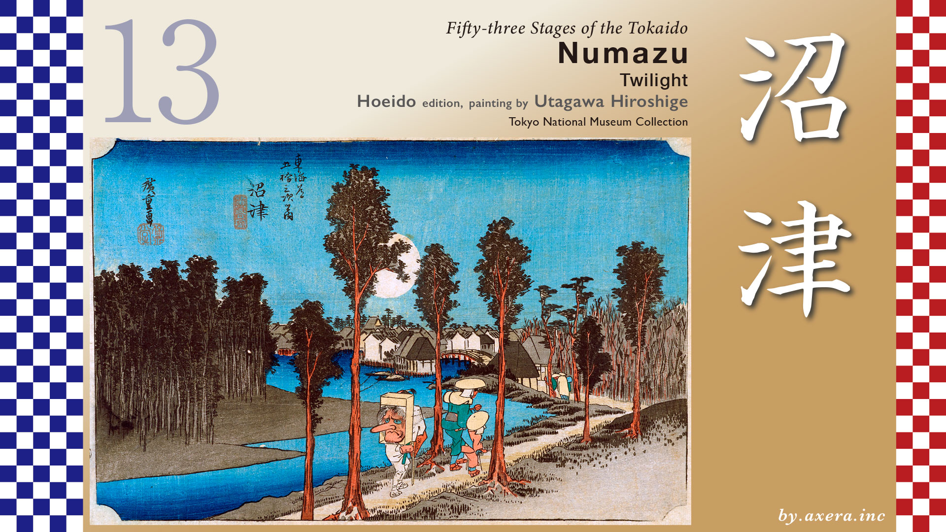
This painting depicts travelers heading toward Numazu-juku along the banks of the Kano River just at twilight.
The distance from Mishima-juku to Numazu-juku was less than 6 km, and it was mostly a gentle downhill.
The Tokaido crosses the tracks of the Izu Hakone Railway, and after passing the Sengan-Doi, it is already outside Mishima-juku, and from here it is a slow descent down the hill to Numazu.
After passing the everlasting light of Akiba Shrine, you will come to Fushimi no Ichirizuka, and further on, you will cross the National Route 1 Numazu Bypass. A little to the left on the bypass, you will come to Kakitagawa Park, which is fed by melted snow from Mt.Fuji.
The Tokaido runs straight ahead from the traffic light at Yahata, Numazu Bypass, and crosses the Kisegawa River, passing by rows of pine trees in Nagasawa. At that time, this row of pine trees and the Kisegawa River were the landmarks of Numazu-juku, and the area from this point onward was under the domain of the Numazu clan.
The Tokaido merges with Yakurazawa Oukan from the right side as soon as it joins 380. This Yakurazawa Oukan is today’s Route 246, which goes around the north side of Hakone. The Tokaido turns left at the Ooka area on a narrower road, keeping the Kano River on the left.
The Tokaido now continues along the bank on the right side of the embankment. After crossing the Kurose Bridge shown in the photo, you will come to the location of the “Twilight” painted by Hiroshige.
After passing this point, the road merges again with Route 380, and after passing the present Misono Bridge, it turns left before Otemachi and heads south. In the Edo period, this area was already within Numazu Castle, and the castle tower could be seen on the right. In the Edo period, this area was a port using the Kano River and was a key location for water transportation in Numazu.
Let’s take a closer look at Hiroshige’s painting.
A large full moon is beginning to rise in the slightly darkened blue sky, giving a little brightness to the Kano River and The Tokaido as it begins to wane. At the end of the road, which curves to the left, we can already see Numazu-juku with its rows of private houses. In front of it is the Sanmaibashi Bridge over the Mujinagawa River. The town of Sammaibashi, with its rows of white-walled storehouses, prospered as a port town. Two straw-covered transport boats are moored on the Kano River.
The four travelers ahead of them have already reached the Sanmaibashi bridge. The mother and child following them look a little tired and their hands are weak from holding their walking sticks. They are carrying a ladle, so they must be two people who are going to Ise for “nukemairi”.
Since when, travelers who were going to Ise began to carry a ladle. In the Edo period, those who carried a ladle were a mark of a person going to Ise, and could receive alms here and there along the way. It is said that food and money were put into the ladle, and sometimes people were even allowed to stay overnight in their homes. In recent years, however, it has been suggested that these were the masters and disciples of the bhikunis, who traveled around the country performing their art.
Another conspicuous feature is travelers carrying tengu masks. During the Edo period, Konpira-dojos dressed in white with tengu masks on their backs traveled throughout the country to spread the Konpira faith. A custom also emerged in which people from all over the country would make a pilgrimage to Sanuki Zouzu-san with tengu masks on their backs when making a pilgrimage to Konpira Daigongen in Sanuki. In recent years, however, a theory has emerged that these people may have been ascetic practitioners who went to Mount Tengura in Owase, beyond Ise.
One question arises here. First, please take a look at this painting, which I believe to be a second print, and which I did not adopt. Don’t you think the balance between the vermilion color of the tengu’s mask and the child’s kimono and the slightly lighter vermilion color on the tree trunk is more natural? However, judging from the degree of smashing of the print, it seems to be a second print.
Please take a look at the next picture we adopted. This painting is indeed a first print, but I thought the color scheme of the wood and the tengu’s mask, dark red and light red, were reversed.
It would be more natural to assume that this is a second print. I suspect that Hiroshige’s color scheme instructions for the first printing were incorrect, or that the craftsman misplaced the woodblocks.
Now, the Reisho edition shows a view of Mt. Fuji over Numazu Castle from the opposite bank of the Kano River, or from what is now the port of Numazu. Fuji over Numazu Castle from the opposite bank of the Kano River or around the present-day Port of Numazu.
Gosho editions depict the process of making katsuobushi, a specialty of Numazu. At the time, Numazu was a major producer of katsuobushi and saba-bushi, which were also paid as taxes to the Hojo clan. The technique of roasting and drying fish by burning wood spread, and it seems that a product similar to today’s “dried bonito” was distributed.
Poem editin depicts Mt. Fuji and Mt. Ashitaka, the end of Numazu-juku, and the marker pole, the wooden board. This indicates that the painting depicts the area around Nishimakado, west of Numazu-juku, where The Tokaido parted from Senbon Kaido.
I actually went to this location. Route 380 joins at this end, but it doesn’t face the river as a view, so it looks a bit strange, doesn’t it?
This photo is taken on the bank of the Kano River, which is closer to the composition of Hiroshige’s painting.
The Mujinagawa River is culverted and no longer exists as a river.
Here, I noticed something a little strange. This location faces almost due west, with the Kano River to the left. In other words, we are not facing the direction of the full moon’s ascent, but the direction of the full moon’s setting and sunset. Since the full moon rises in the east at twilight, as the subtitle suggests, Hiroshige clearly misunderstood the direction of this location.
This is the entrance to the road that goes around the castle along the castle perimeter, just before the Otemachi intersection. It is now called Kawagurwa-dori street. Beyond this point, on the right, there was the keep of Numazu Castle, although it is now a park. From this end to the left is the embankment of the Kano River, which in the Edo period functioned as a port to support the distribution of goods in Numazu.
Please also see Google Street View looking almost directly west from above here. The Tokaido has been added in orange. You can see that Numazu has changed a lot since those days, when there were only forests and a few houses. Of course, we can still see the setting sun and the setting moon, but even now we cannot see the rising moon in this direction.
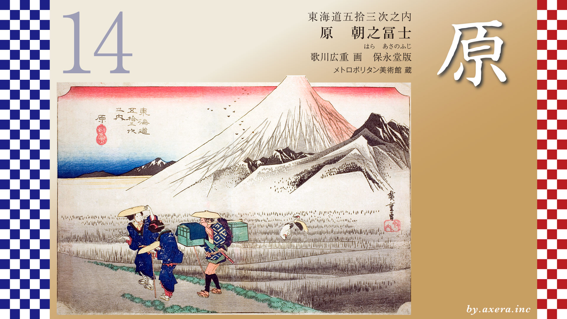
The Tokaido continues along Senbon Matsubara in Numazu toward Hara-juku.

コメント