
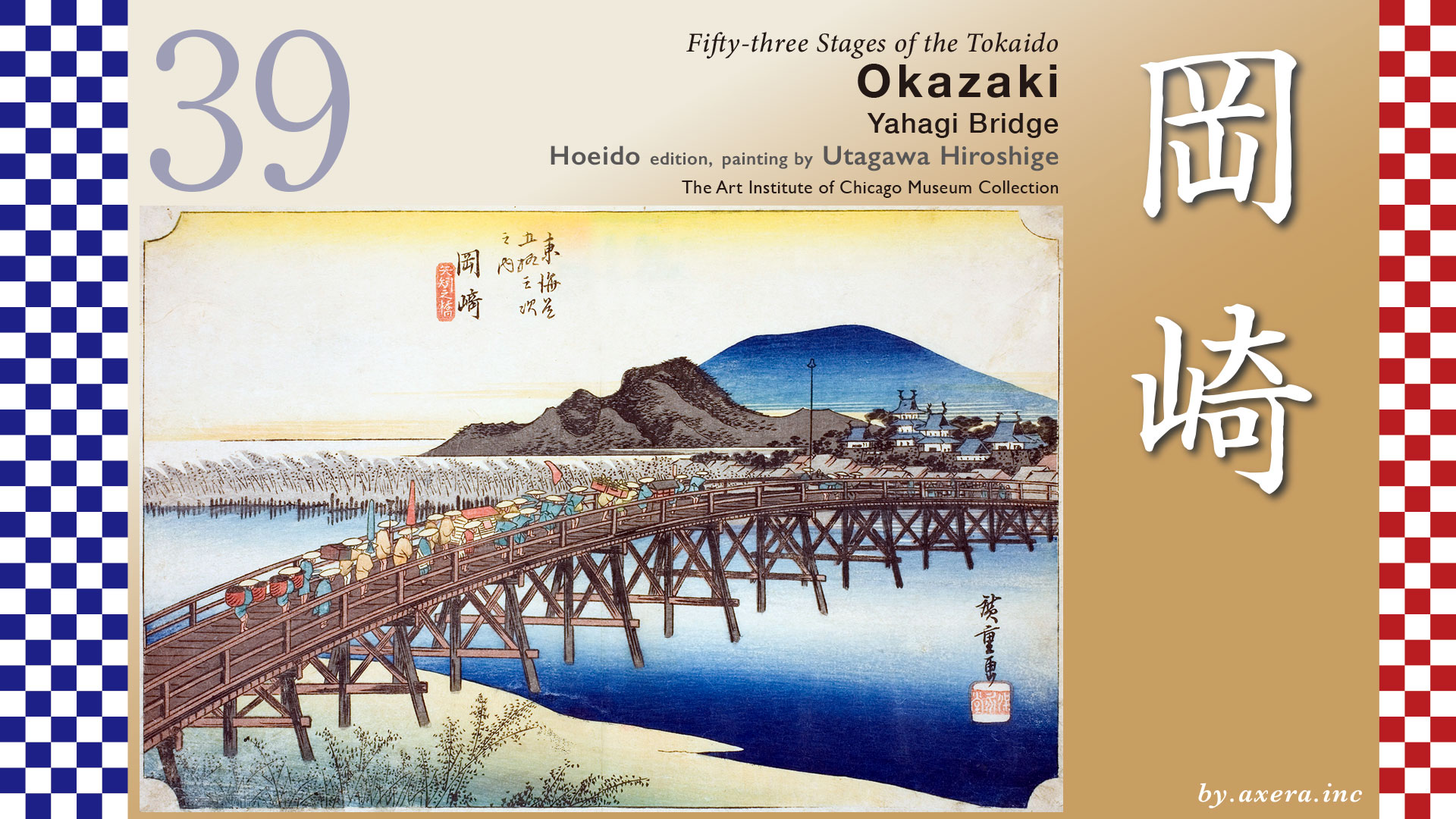
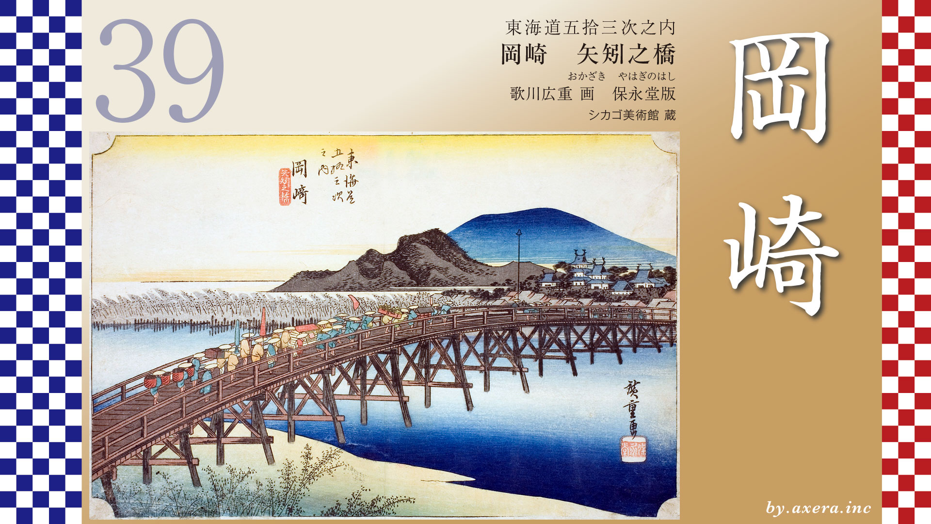
Fifty-three Stages of the Tokaido
Okazaki
Yahagi Bridge
Hoeido edition, painting by Utagawa Hiroshige
The Art Institute of Chicago Museum Collection
This is Yahagi Bridge, once praised as “the greatest bridge in the land.”
And beyond it rises Okazaki Castle, the birthplace of Tokugawa Ieyasu himself.
The distance from Fujikawa-juku to Okazaki-juku was one and a half ri, about six kilometers.
Leaving Fujikawa-juku, the road soon passes through the hills, heading northwest, never straying far from what is now National Route 1.
Just after crossing the Meitetsu railway, the scenery suddenly changes.
A long stretch of pine trees begins here ―
the famous Fujikawa Pine Avenue.
In its prime, the pines dominated the landscape for a remarkable distance.
Even today, remnants remain along the old road until it merges with Route 1.
During the Edo period, the Tokaido ran straight across the Otogawa River at this point.But today, the bridge is gone, and the route is forced to detour along the Route 1.
Beyond the river lies Ohira Town.Here stood the jin’ya, or administrative headquarters, of the Nishi-Ohira Domain ―built by none other than the legendary magistrate, Ooka Echizen no Kami Tadasuke.
The Tokaido then passes alongside the Okazaki Interchange, leaves Route 1, and follows a narrow eastern path.
On the right stands a stone lantern of Akiha Shrine.
From here on, you have officially entered Okazaki-juku.
Look closely at this enlarged map.
The roads around Okazaki-juku twist and turn in an almost unnatural way.
Every bend served one purpose: defending Okazaki Castle.
This maze-like layout is known as the “Twenty-Seven Turns.”
Its eastern starting point was the Kaburagi Gate ―
now replaced by a modern traffic roundabout.
The heart of the relay station lies at what is now the Denma-cho intersection.
This area once concentrated the town’s key facilities:
the Honjin, relay offices, and the Toiya.
Eventually, the Tokaido makes a wide detour around Okazaki Castle and heads toward the Yahagi River.
Here, warehouses of Hatcho miso line the street.
A short distance further north stood Yahagi Bridge.
Utagawa Hiroshige is believed to have drawn Okazaki Castle from the far side of this bridge, after crossing it.
The red gradient marks his presumed viewpoint.
Okazaki Castle was famous as the birthplace of Tokugawa Ieyasu.
For that reason, it was ruled by fudai daimyo, hereditary retainers of the Tokugawa.The Okazaki Domain itself, founded by the Honda Hikojiro family, held only 50,000 koku ― a relatively small domain.
Yet the Yahagi River was a vital artery for water transport.
Combined with the castle’s prestige, becoming lord of Okazaki was considered a true status symbol among daimyo.
Supported by the legacy of the Shogun’s birthplace, Okazaki-juku grew into one of the largest relay station on the Tokaido ―second only to Sunpu in Suruga Province.
At the time Hiroshige created this print, Okazaki Castle was ruled by the Honda Heihachiro family.
Descendants of the famed Honda Tadakatsu, they maintained a large retinue of retainers.
Managing a domain of only 50,000 koku under such conditions was, unsurprisingly, a serious financial burden.
Now, let’s examine Hiroshige’s artwork more closely.
Yahagi Bridge was the longest bridge on the entire Tokaido.
It was washed away and rebuilt many times.
At its longest, it stretched 380 meters, supported by seventy bridge pillars.
People even said,
“Mention Okazaki, and you think of Yahagi Bridge.”It was the very symbol of the highway.
According to Edo-period bridge rankings,the western champion was Kintai Bridge in Yamaguchi ―and the eastern champion was Yahagi Bridge.
Now look carefully.
A daimyo procession is crossing the bridge, heading toward Okazaki Castle.
The vanguard ― the spear-bearers and chests ― has already reached the middle of the bridge.
Leading the procession is the advance guard:the heralds, porters, and spear carriers.Behind them comes the main body, centered on the lord’s palanquin.
Following are umbrella bearers, attendants, tea servers, lunch carriers, and more spear men.
The level of detail here is astonishing.
You can practically feel the effort Hiroshige put into rendering this procession accurately.
It is said that Hiroshige relied on the Tokaido Meisho Zue as a reference.
In that source, the procession approaches from the Okazaki Castle side.
A checkpoint should appear in the middle of the bridge ―yet Hiroshige deliberately chose to omit it.
In the Reisho edition, the artist focuses on the rear of the procession.
Two rafts float on the river, emphasizing not only the Otogawa, but also the broader river traffic of Okazaki.
In the Gyosho edition, something amusing appears.
An ordinary citizen, holding a parasol, casually rides a horse behind the procession.
The laborer at the rear watches him with a smile.
Okazaki Castle can be seen in the distance.
The Poem edition again highlights Okazaki Castle and Yahagi Bridge,
showing how river transport along the Yahagi River supported the prosperity of the relay station.
Katsushika Hokusai also depicted Yahagi Bridge in his series of famous bridges across Japan.
Like Hiroshige, he included a daimyo procession ―
but his version is far more dynamic, with the bridge arching upward like a drum.
Hokusai painted Yahagi Bridge even earlier, in 1804,in what is often called the “Hokusai Tokaido.”
The shrine on the right is likely Yahagi Shrine,suggesting a view from the Okazaki Castle side.
The resemblance to Hiroshige’s composition ― especially the mountain shapes ― is striking.
Finally, I visited the site myself.
This is the view from where Yahagi Bridge once stood.
On the left is the modern Yahagi Bridge.
On the right, the Meitetsu railway bridge.
The castle tower, reconstructed in 1959, now appears small, surrounded by buildings.
So if we imagine today’s Yahagi Bridge as the old Yahagi Bridge,
and look toward Okazaki Castle once more ―
Now then—
let’s use Google Street View and take a look at Okazaki Castle from slightly above.
In its day, Okazaki Castle was one of the three largest castles in the Tōkai region.From its present appearance, that scale may be difficult to imagine.
But in 1873, the sixth year of Meiji.
The new government issued the Castle Abolition Order.
The keep, along with many of the buildings that once surrounded the castle, was dismantled.The land was sold off.
Later, it was redeveloped into shrines and what is now Okazaki Park.
The once-massive castle had, quite simply, finished its role as the age itself turned a new page.
Seen from above like this, it becomes clear just how profoundly the Meiji Restoration transformed both the Tokugawa family and the castles that symbolized their power.
Next, let’s mark the location of the former Yahagi Bridge with a blue dashed line.
You can immediately see just how long this bridge was.
And remember—this was a wooden bridge, built in an era with no heavy machinery, constructed entirely by human labor.
Once again, we can’t help but be impressed by the level of civil engineering skill and the sheer manpower involved.
Now, let’s shift our gaze forward.
Using Google Street View, we look in the direction of travel along the Tōkaidō.
After crossing Yahagi Bridge, the road curves gently onward,
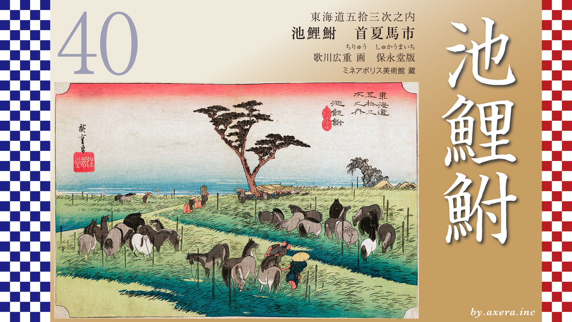
leading to the next post town: Chiryu-juku.
And in the distance—the waters of Ise Bay begin to appear, little by little.
The journey along the Tokaido is finally drawing closer to the sea.
コメント