
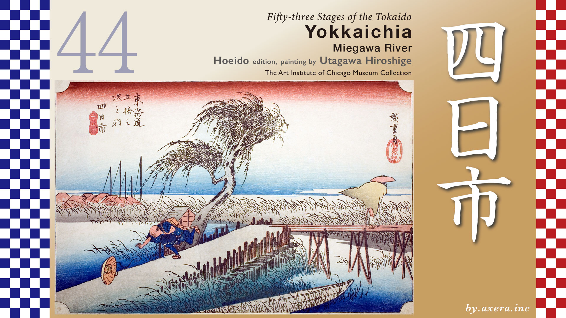
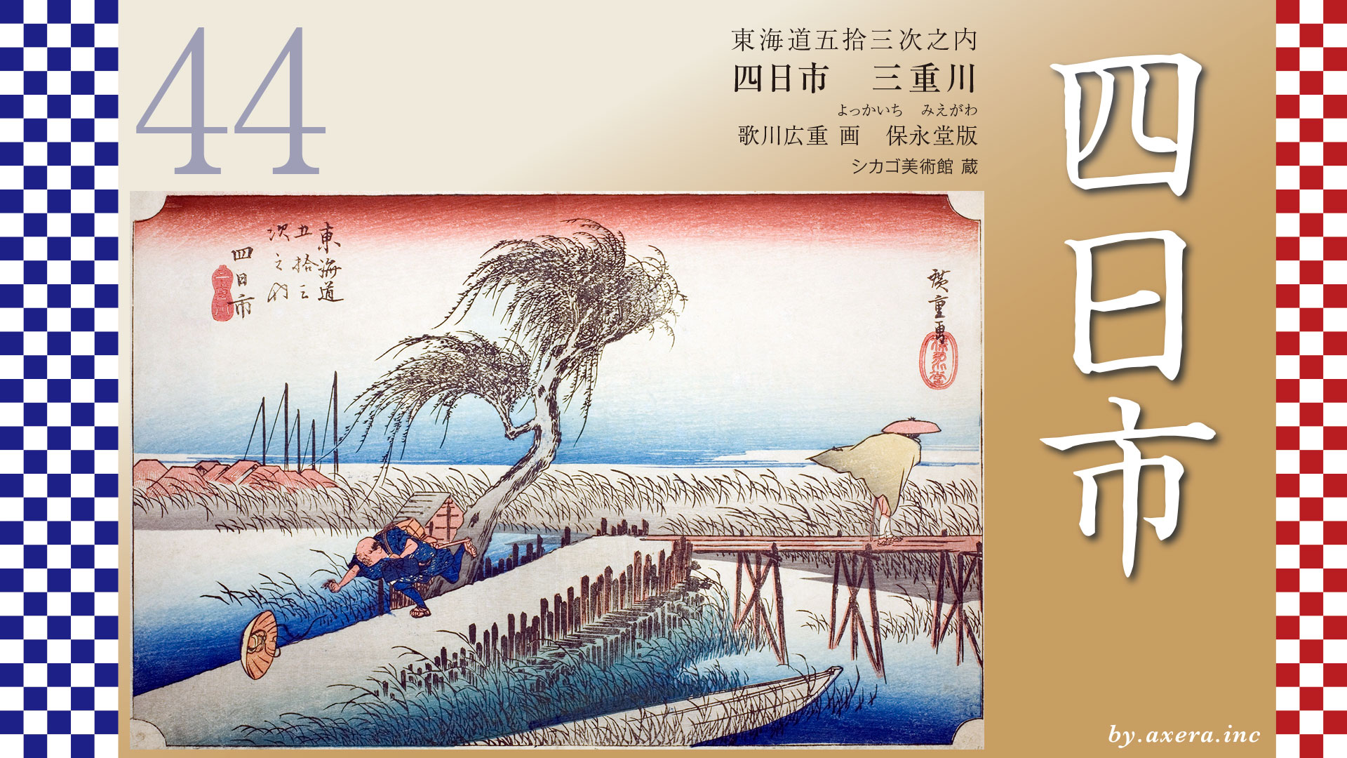
In this scene, we are looking at a view depicting the area around the Mie River―today’s Mitaki River―where the Tokaido crossed just before reaching Yokkaichi.
Travelers, having arrived at Kuwana Juku via the Shichiri Ferry Crossing, set out once again, heading about 13 kilometers south-southwest toward their next destination, Yokkaichi Juku.
After leaving Kuwana, they passed through the zigzagging streets typical of a castle town before gradually turning south. Near Machiya Bridge stood a stone lantern dedicated to the Ise Grand Shrines, quietly watching over the travelers. Today, both the name of the river and the location of the bridge have changed, reminding us of the passage of time.
The Tokaido passes beneath the Kintetsu Line, follows the JR Kansai Main Line southward, and, after passing under the Isewangan Expressway, reaches the Matsudera rest station.
After passing under the JR Kansai Main Line and two Kintetsu lines, travelers arrive at the Tomida Ichirizuka milestone mound. This was a resting place that Hiroshige depicted in his Gyosho edition “Kuwana” print, showing a clam shop.
Continuing southward for a while, travelers cross the Kaizo River―now famous for cherry blossoms―then the Mitaki River, and enter Yokkaichi Juku. Hiroshige’s depiction of Yokkaichi shows this very spot, just before the Mitaki River, which served as the gateway to the Yokkaichi Juku. Today, the Tokaido runs through a lively covered shopping arcade near the station called “Suwamae.”
After passing through Yokkaichi, a large torii gate soon comes into view. This is Hinaga no Oiwake, an important junction where the Tokaido and the Ise Kaido―Pilgrimage Road diverge. Beyond the gate stretched the road leading to Ise Grand Shrine.
Let us now enlarge the area around Yokkaichi, highlighting Hiroshige’s viewpoint with a red gradient.
The “Mie River” mentioned in Hiroshige’s subtitle refers to the Mitaki River. Upstream, in Komono, lies Yunoyama SPA, a hot spring resort long cherished as a therapeutic retreat, which supported the region’s prosperity.
Immediately after crossing the river, Yokkaichi Juku had its Honjin. In the past, the road ran straight all the way to Suwa Shrine. Although it is now divided by a national highway, we can still imagine its former appearance.
Let us look again at the wider map.
At that time, there was also a route that went directly from Miya Juku to Yokkaichi without using the Shichiri or Sanri ferry crossings. This was known as the Juri Ferry Crossing. Established in 1601 with the approval of Tokugawa Ieyasu, it began on a small scale but gained many users from the mid-Edo period onward. Travelers found it more convenient to continue directly to Yokkaichi rather than heading north for about one ri back to Kuwana.
However, as a result, Kuwana Juku, which lost customers, submitted petitions of complaint to the road magistrate. Even in those days, various interests and rivalries were at play.
Now, let us turn our attention to Hiroshige’s image.
In the strong wind, one traveler crosses the bridge holding down his raincoat, while another desperately chases after his flying sedge hat. This contrast vividly conveys both the hardship of travel and human warmth. The willow branches, blown by the wind, testify to the stormy weather of that day.
In the distance, we see the roofs of Yokkaichi and the sails of cargo ships anchored in the harbor. This sea was once called Nako-no-ura Bay and was famous for mirages. It was believed that within the mist rising from clams, the gods of Ise and Atsuta traveled, creating visions of palaces and towers.
The bridge was a simple structure combining an earthen bridge and a wooden bridge. Reeds grew thickly along the riverbank, and boats were quietly moored there. It was a landscape where travel and daily life were closely intertwined.
In winter, Yokkaichi is well known for the “Suzuka Oroshi,” strong northwesterly seasonal winds that blow down from the Suzuka Mountains. Facing Ise Bay, the area is also exposed to sea winds. On clear winter days, gusts could be so strong that people could barely stand. Hiroshige seems to have captured this atmosphere with lightness and humor.
The Reisho edition depicts the scenery of Hinaga no Oiwake. After Yokkaichi, travelers reached Hinaga, an intermediate Juku, beyond which the Tokaido and the Ise Kaido diverged. This place was famous for its torii gate and manju sweets, and Hiroshige portrays the lively junction. A samurai feeding an “okage dog” making a pilgrimage to Ise on its own is a particularly charming detail.
The Gyosho edition likewise shows the torii gate and the sweet shop.
Ise Province was originally a major rice-producing region, and prices in Kuwana even influenced rice markets in Edo and Kyoto-Osaka. From this environment emerged red-bean rice cakes that soothed weary pilgrims. Even today, the route from Kuwana to Ise is called the “Rice cakes Road,” and many varieties of delicious rice cakes are made throughout Mie Prefecture.
The “manju” in Hiroshige’s prints is probably what is locally called “nagamochi.” Please take a look at the Naga Mochi near Kuwana Station, which I personally love. Because it is made with fresh rice cakes, it does not keep long, but it is very delicious. On the left side after crossing the Mie River stands the main shop of Sasaiya, now famous for Yokkaichi’s naga-mochi.
In the Poem edition, the bridge is viewed from even farther away, showing a line of pilgrims heading for Ise. Among them are young people making secret pilgrimages without their masters’ permission. This reflects the deep popular faith of the time.
Photographs from the Taisho era show that the bridge was still a fine wooden structure. Pine trees lined the embankment, creating a dignified landscape.
I have actually visited this place.
Today, it is a modern Mitaki Bridge. Beside the railing supports, large red-and-white smokestacks can be seen―marking the area of present-day Yokkaichi Port. When the bridge was still wooden, the sails of ships anchored in Nako no ura Bay could be seen in the distance.
This is a view of Mitaki Bridge from a little farther away. Just behind it runs the five-lane National Route 1 Yokkaichi Bridge, and farther back is the Kintetsu railway bridge. The red-and-white smokestacks in the distance belong to oil companies, with the JR Kansai Main Line and National Route 23 running in front of them.
Using Google Street View, we can look at the direction of the Tokaido from above the Mitaki River. Due to river improvement works, the river appears much wider than it was in the past.
This is the current torii gate of Ise Grand Shrine at Hinaga no Oiwake. Let us also view it from above using Google Street View.
Today, buildings stand densely packed here, but in the past there were only a few teahouses. Whichever road one took―the Tokaido or the Ise Kaido―Pilgrimage Road there were only rice fields and narrow paths between them. It is said, however, that many travelers coming from Edo chose to head toward Ise.
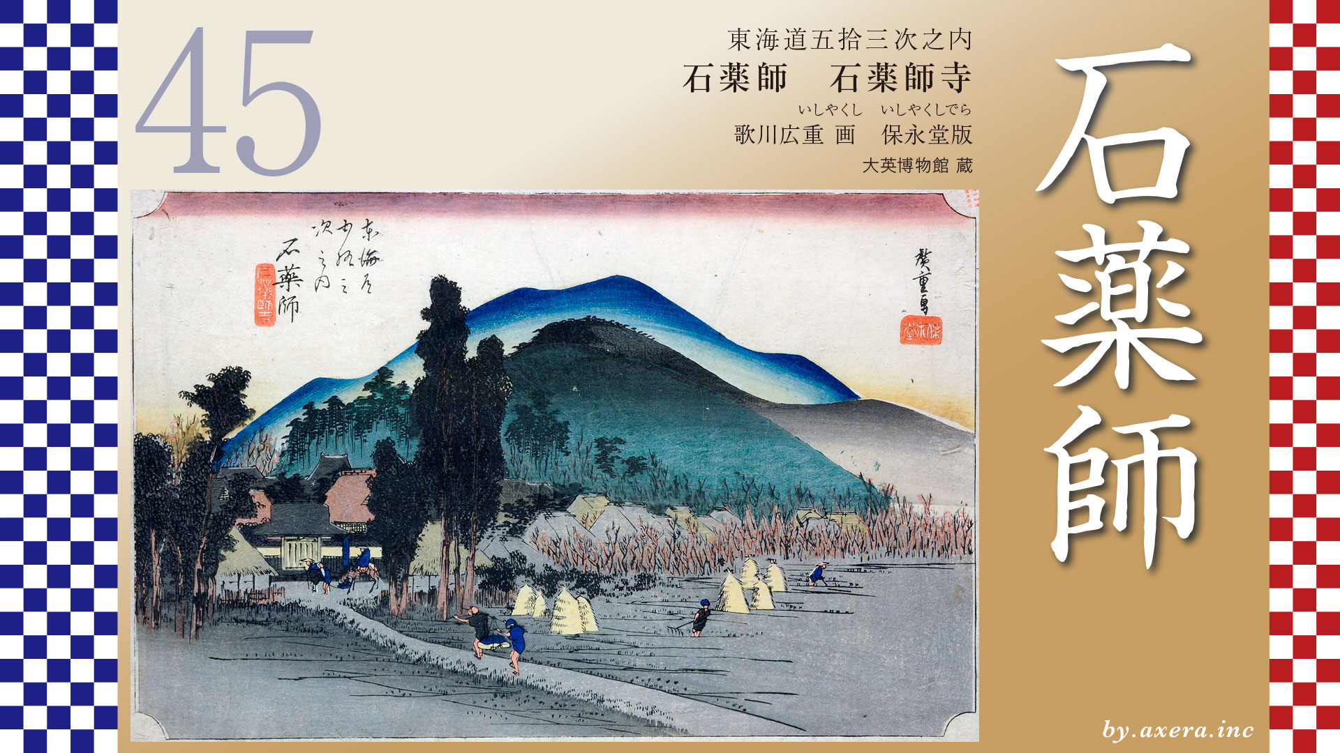
From here, the orange-colored Tokaido continues along the quieter road to the right, leading toward Ishiyakushi Juku.
コメント