
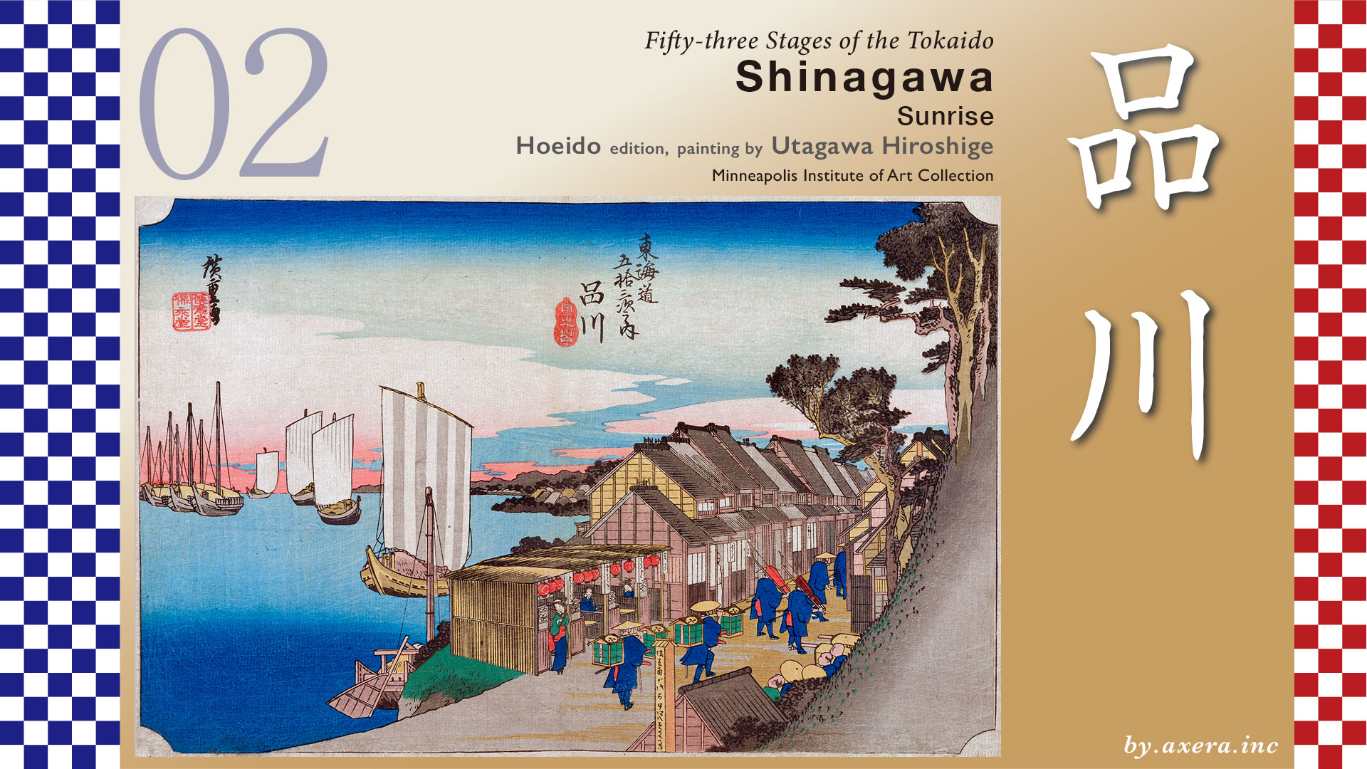
This depicts the Tokaido around the entrance to Shinagawa-juku and the sea to the east seen beyond.
Shinagawa-juku was about 8 km away from Nihonbashi, and if one left Nihonbashi early in the morning before 4:00 a.m., one would arrive just as the sun was rising. The people of Edo must have had good legs.
After leaving Nihonbashi, crossing Kyobashi and passing through Ginza, you will reach Shiodome. About 67 years after Hiroshige painted this picture, Japan’s first railroad station, the first Shimbashi Station, was built on the left side of this picture.
After passing this station, the road passes in front of the main gate of Zojoji Temple, the family temple of the Tokugawa Shogunate, and when it reaches Shiba, the road turns slightly to the right and proceeds along a large left-turned arch. In the Edo period, the sea was immediately to the left along this archway. From Shiba to Shinagawa, many Edo citizens visited this area in autumn as it was a famous place for viewing the moon.
This arched road leads past Tamachi Station to Fudanotsuji, and a huge redevelopment project is currently underway from this left side to Shinagawa Station. This is a wide-area urban development associated with the construction of the newly built station, Takanawa Gateway Station and its surrounding area.
Please see a slightly enlarged map. As Shinagawa Station nears, you will see a forest of Prince Hotels on the right.
Here is a superimposed JHICO MAP showing the state of the coastline at that time. You can see that the area around the present Shinagawa Station was a shallow sea with sandy beaches. This is where the story of “Shinagawa Shinju,” a famous rakugo (comic storytelling) piece, about a man who jumped into the sea but did not die, comes from.
In the Edo period, there were two mountains, Yatsuyama and Gotenyama, on the right side of the road.
Hiroshige depicted it in a series of three paintings. Gotenyama, a wide, flat, grassy plateau with a view of the sea, was a popular hanami viewing spot for Edo citizens. The painting depicts the houses of Shinagawa-juku standing in a row on the left and many people walking along the Tokaido. This shows the relationship between the city of Shinagawa and Edo Bay.
However, about 20 years after Hiroshige painted the Fifty-three Stations, the black ships suddenly appeared, forcing the shogunate to rush to consider defending Edo. To make room for the earth, Yatsuyama and Gotenyama were destroyed. Of the seven platforms that were to be built, three can be seen on the right. The first platform is marked as “Rita Shinden” and is now the Daiba Elementary School of Shinagawa Ward.
Let us now return the map to the present day and show Hiroshige’s point of view in red gradient. This gives us a rough idea of Hiroshige’s point of view.
Next, please see the GSI map looking at the entire Shinagawa-juku. This is covered by a map from 1881, which still shows the Edo period. The Tokaido is also depicted on this. You can see that even in the early Meiji Era, Shinagawa-juku was a town facing the sea.
The town of Shinagawa is located at the mouth of the Meguro River, and fishing villages were first formed in this area, spreading from north to south. Eventually, Shinagawa was officially designated as an inn town by the Shogunate, and Toiyaba, inns, and tea stores began to increase.
It is said that the area was about 2 km long from Yatsuyamaguchi in the north to the border between Aomono-Yokocho and Samezu in the south, with one Honjin, two Wakihonjin, 111 inns, 64 teahouses, and about 7,000 people living in the area.
Therefore, Shinagawa-juku was divided into three zones across the Meguro River: Minami-shinagawa in the south, Kita-shinagawa in the north, and Kachi-shinjuku in the far north. The blue zone, Kachi-shinjuku, was where new inns and teahouses were developed and were exempted from taxes, and was the last to be added to Shinagawa-juku.
Hiroshige painted this Kachi-shinjuku about as soon as he entered it.
Please see Hiroshige’s painting here.
It is said that the travelers left Nihonbashi before 4:00 a.m. and reached Shinagawa by 6:00 a.m. As the subtitle “Hinode” indicates, the painting depicts clouds that turn slightly red and the blue sky beautifully. It is a little difficult to see, but in the first print, the morning sun can be seen slightly ahead of the ship with its sails down on the left side.
This painting depicts the northern edge of Shinagawa relay station, just at the entrance to the shuku, as can be seen by the Boji-kui (Marker Pole) indicating the entrance to the shuku, in the middle of the painting. The last group of the daimyo’s procession is depicted on the road, with no onlookers bowing their heads as they reach this point, just watching the procession.
On the sea, a number of large boats of the time, known as bensai boats, are depicted and can be seen from Samezu to as far as Haneda in the distance. The mountain on the right appears to be Yatsuyama, but it seems to be drawn as if it is extremely steep. Shinagawa, because of its location on the Tokaido, was also a place where people who were leaving Edo on their journeys and those who were seeing them off bid farewell to each other.
Please take a look at a painting by Toyokuni Utagawa depicting a moon-viewing party at that time. Shinagawa was a place where prostitutes called “Meshimori-onna” were allowed to stay in inns during the Edo period. Therefore, in contrast to the Yoshiwara brothels in the north, Shinagawa was called “Minami” (south) and was a busy entertainment district. In addition, the area was blessed with seafood called “Edomae,” and in the fall, it was a famous place for viewing the moon, and famous restaurants lined the streets. Shinagawa-juku was not only a shuku, but also an easy day-trip destination from Edo.
The Shinagawa relay station painting has a variant with a different subtitle.
In the variant, the composition of the daimyo’s procession is different and the number of people in the procession has increased.
The Reisho version looks toward North Shinagawa from a teahouse near Samezu in Minami-Shinagawa, just beyond the Meguro River. Beyond the Bensai-boat, the Takanawa area can be seen.
The Gyosho version is still a morning view of Samezu, but the sea is depicted with nori hibi (laver cracks) and nori fishermen, and the customers at the teahouse seem to have just finished eating the specialty anago chazuke (eel stew) shown on the sign. It is an Edo-style specialty.
The Poem version depicts an inn in Kitashinagawa with its eaves lined and the Tokaido. At the far right, along the Meguro River, the fishing village of Suzaki is also depicted, where the fishermen relied on a Benten shrine called Rita Shrine.
If you look at these views in succession, you can see a series of views from the north, and you can get some idea of what Shinagawa looked like at that time.
I went to the actual place, which is probably this location. The view to the left, which at that time overlooked the ocean, is now covered with buildings.
This is a view of Tokaido from a little further south, in front of a restaurant called “Dozo Sagami,” which was the most famous restaurant in Shinagawa at that time. The Tokaido is now a one-way shopping street with colored pavement.
This is a view from Hiroshige’s point of view looking left, toward the sea. The intersection at the bottom of the hill should have been the edge of the surf, but the buildings continue to stand for a long time beyond that point.
Looking at the present Shinagawa-juku from the sky with Google MAP, you may wonder where is the sea? It is like “Where is the sea? It is a sign of the times. In those days, the road you can see just beyond the building on the left was already the sea.
Please also see GoogleMAP from a little higher up. I included the Tokaido ahead in orange together.
I painted this with blue for the area that would have been the sea at that time. What do you think? Shinagawa-juku was supposed to have been a seaside entertainment district, but in less than 200 years, the railroad passed through, a wide road was built, and the mountains were broken down to fill the shallow sea. Today, the only trace of the sea remains in a canal that has been spared from land reclamation, where an information board for the Shinagawa-ura boathouse still stands.
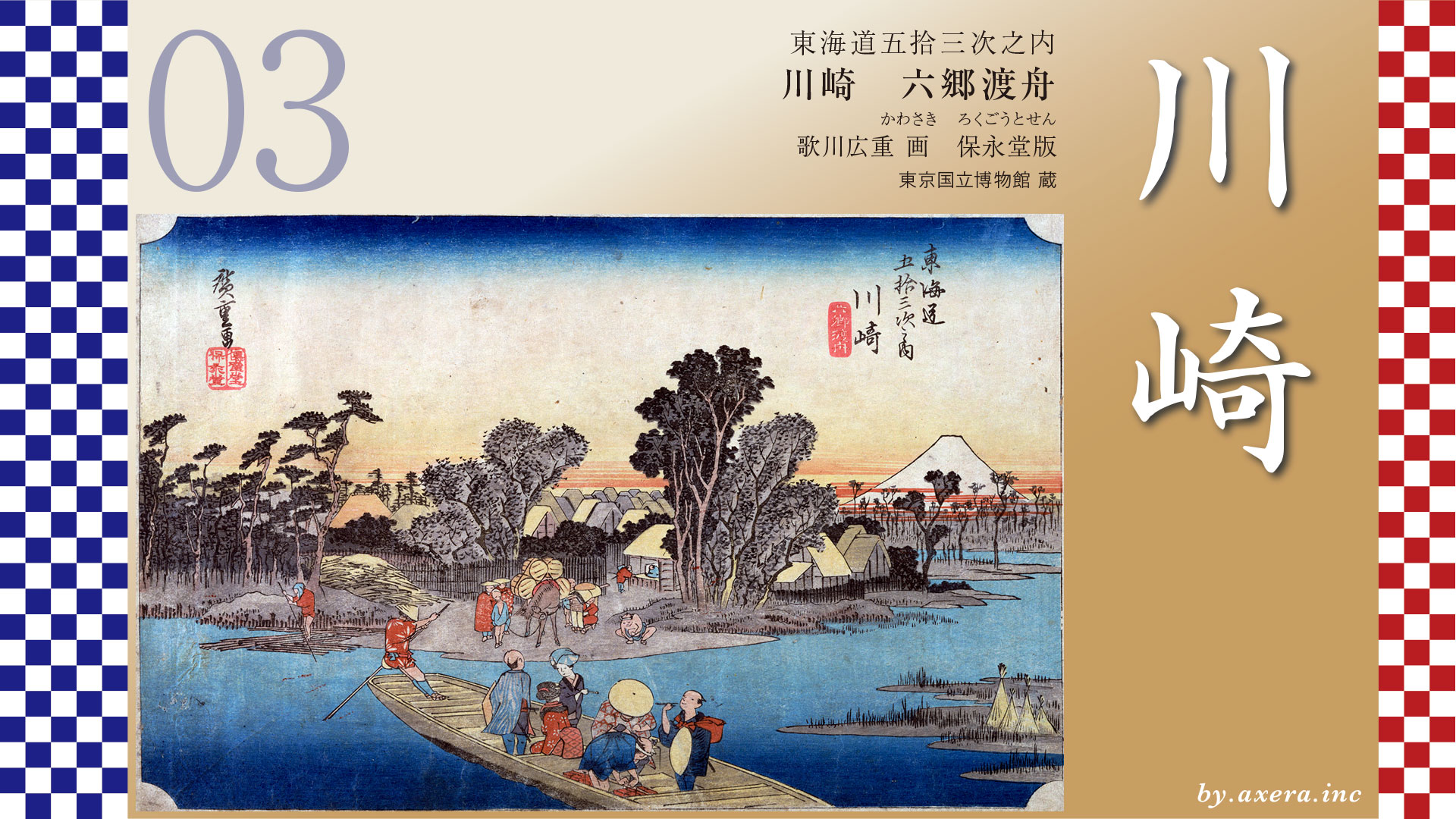
The Tokaido continues onward to Kawasaki Juku at the far right.
コメント