
Fifty-three Stages of the Tokaido
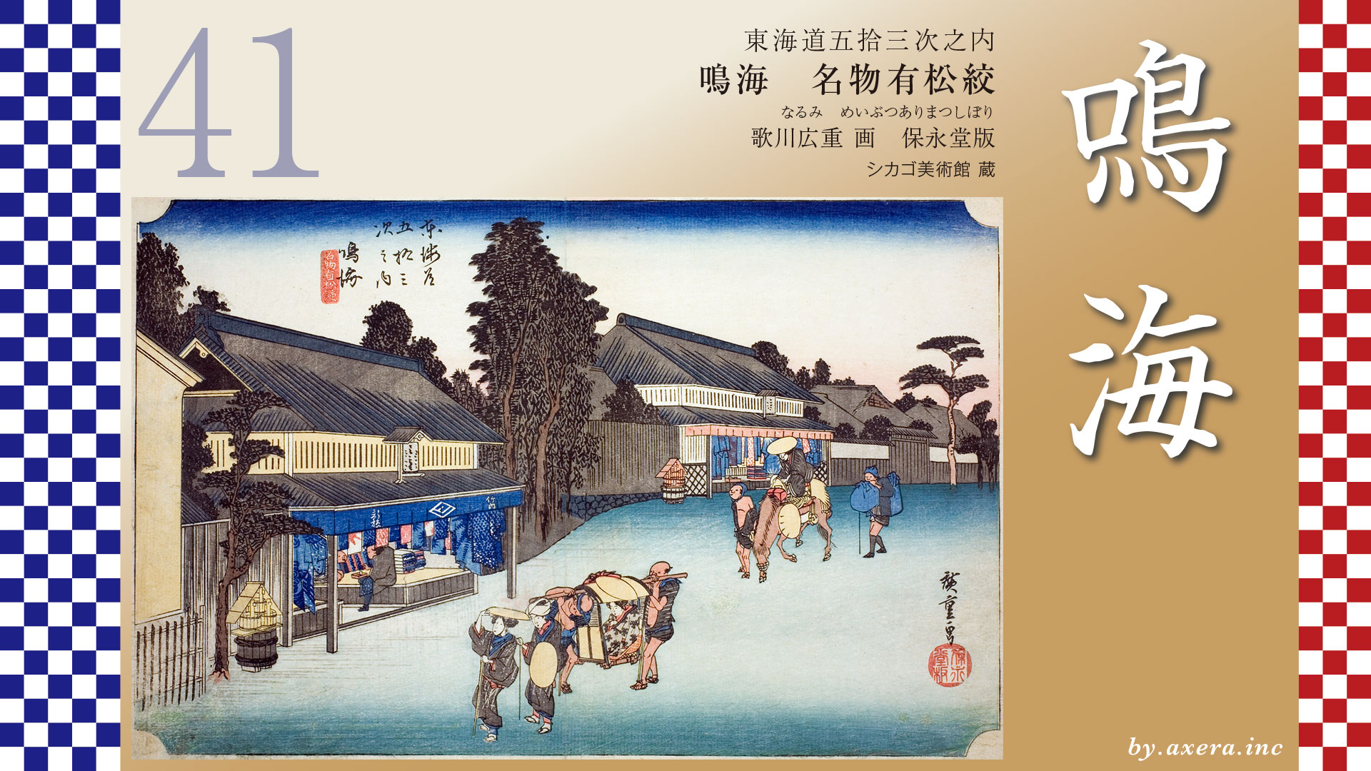
Narumi
Famous Arimatsu Tie-dyed Fabric
Hoeido edition, painting by Utagawa Hiroshige
Art Institute of Chicago Museum Collection
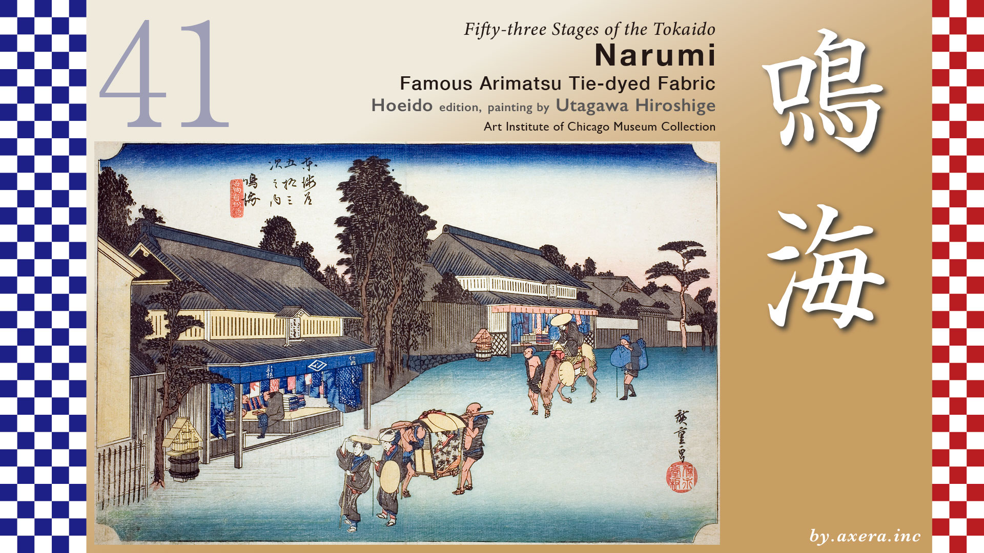
This image depicts the storefronts of Arimatsu tie-dye shops lining the Tokaido, just before reaching Narumi-juku.
Leaving Chiryu-juku, the Tokaido heads northwest for about eleven kilometers toward the next post town, Narumi-juku.
Arimatsu, the setting of our story, lies just 2.5 kilometers before Narumi-juku.
After departing Chiryu-juku and crossing the Aizuma River, one soon comes upon the quiet remains of the Hitotsugi Ichirizuka, standing modestly beside a pedestrian overpass.
Without knowing it is there, one might easily pass it by.
From this point, the Tokaido runs alongside what is now National Route 1, winding north and south as it goes.
Crossing the Sakaigawa River and passing beneath the elevated Isewangan Expressway, the road enters present-day Toyoake City.
A little farther on, the route leaves National Route 1 and turns left onto a narrow side road.
Here stands the Ano Ichirizuka, still preserved today as an impressive historical site.
To the left of Meitetsu Chukyo Keibajo-mae Station lies the old battlefield of Okehazama.
Here, the Tokaido once again departs from Route 1 and slips back into a quiet country path.
The Battle of Okehazama took place in 1560, during the third year of the Eiroku era.
Imagawa Yoshimoto, leading an army of 25,000, invaded Owari Province.
Oda Nobunaga launched a surprise attack and killed Yoshimoto, winning a decisive victory.
This battle allowed Nobunaga to fully secure control over Owari.
Matsudaira Motoyasu—later known as Tokugawa Ieyasu—who had been held as a hostage by the Imagawa clan, formed the Kiyosu Alliance with Nobunaga and regained his independence in Mikawa.
Here, quietly, the course of Japanese history shifted.
Now, let us return to the map.
Passing through the Arimatsu Preservation District and approaching the Nagoya Daini Ring Road, we find the remains of the Arimatsu Ichirizuka, still standing quietly by the roadside.
Less than a kilometer beyond it appears the Hirabu stone lantern.
This marks the official eastern entrance to Narumi-juku.
That said, the area where the main inn of Narumi-juku once stood now feels somewhat subdued, like a back street fallen out of use.
It stands in sharp contrast to the lively townscape of Arimatsu.
Let us now take a closer look at the two Arimatsu tie-dye shops depicted by Utagawa Hiroshige.
In front of the shops are rainwater barrels prepared for fires.
Tiled roofs, lattice windows, and mizuhiki noren curtains all suggest prosperous merchant households.
Some believe these shops may have belonged to the Takeda or Oka families.
At the shop on the left, a figure who appears to be a samurai is engaged in business negotiations at the raised entrance.
Around him hang what seem to be samples—yukata and bolts of cloth dyed in crimson and indigo.
Bold, large-scale patterns—this is the hallmark of Arimatsu tie-dye.
In the back, bolts of fabric are stacked neatly, rendered with remarkable realism.
In the foreground stand two women.
The woman on the left seems eager to stop and browse, while the woman behind her appears to urge, “Let’s hurry on.”
Behind them, another woman is just stepping down from her palanquin.
The bearers adjust their posture and gently lower it—
even such fleeting movements are carefully captured.
The shop on the right appears to stand on slightly higher ground.
A woman riding a horse down the slope naturally leans forward.
These subtle details give the scene a vivid sense of life.
In the Tokaido Meisho Zue, the very process of making Arimatsu tie-dye is depicted.
Women work intently at the tying, while a samurai peers in.
A laborer receives a light for his pipe.
To the right, a child hangs freshly dyed cloth out to dry.
In the Reisho edition, the townscape of Arimatsu is shown in strong perspective, with rows of tie-dye shops stretching into the distance.
At the time, there appear to have been about twenty such shops.
The primary customers were likely women.
In the Gyosho edition, the interior of the shops is shown in even greater detail.
Beyond red and indigo, we learn that green dyes were also used, made from the bark of the kihada tree, known for its medicinal properties.
In the Poem edition, the town is depicted from the opposite direction, presenting a lively view of large, prosperous shops.
Then there is Hokusai’s Tokaido: Narumi.
Here, women engaged in the tie-dyeing process are portrayed with a subtle sensuality.
At a glance, one can tell what they are doing.
It reminds us that ukiyo-e functioned as a kind of guidebook for travelers.
The fact that so many works depicting the Narumi area focus on Arimatsu tie-dye speaks volumes about its fame.
Let us now look at the Tokaido Bunken Ezu map.
Though it dates to the mid-Edo period, it shows little more than trees between Ochiai village and Narumi-juku, with the exception of Arimatsu.
The Senninzuka mound marks a burial site for those who died in the Battle of Okehazama.
When overlaid with a modern map, the geographical relationships become clear.
In the early Edo period, Arimatsu was an uninhabited wilderness, covered with pine forests.
It was also a dangerous area frequented by bandits.
To address this, the Owari Domain established a settlement here in 1608, offering incentives such as tax exemptions to settlers.
One of the eight pioneering families was led by Takeda Shokuro, who would later drive Arimatsu’s remarkable development.
In 1610, many samurai and laborers from the Bungo Funai Domain stayed in the area for the construction of Nagoya Castle.
Shokuro took notice of the Bungo-style tie-dyed garments they wore.
With little farmland available, Shokuro chose tie-dyeing as Arimatsu’s new industry.
He named his technique “Kukuri Shibori” and began producing tenugui cloth dyed on Mikawa and Chita cotton, selling them to travelers along the Tokaido.
Eventually, the Owari Domain designated Arimatsu tie-dye as an official domain specialty, granted it monopoly rights, and appointed Shokuro as an official merchant.
Arimatsu tie-dye became known throughout Japan—an impressive example of early marketing strategy.
Later, Arimatsu was completely destroyed by a great fire in 1784.
This time, however, the town was rebuilt using fire-resistant nurigome-zukuri construction.
Thus, the townscape that survives today was born.
Arimatsu tie-dye continues to be handed down as a traditional craft, and the merchant townscape quietly tells the story of its former prosperity.
Now, let us visit the site itself.
Present-day Arimatsu is a town of tie-dye that strongly retains the atmosphere of the Edo period.
The view that overlaps with Hiroshige’s composition is likely around this area.
Part of the town has been designated an Important Preservation District for Groups of Traditional Buildings, and at the Arimatsu-Narumi Tie-Dye Museum, visitors can easily learn about its history and techniques.
Looking back toward Chiryu from Arimatsu on Google Street View—
In the early Edo period, this area was a desolate stretch of land with few houses, known as a dangerous part of the highway where bandits were said to lurk.
Yet today, before our eyes, we see a calm townscape—an inhabited place where everyday life quietly continues.
The Tokaido was more than just a road for travel.
It served as a conduit for people, goods, skills, and ideas—playing the role of an incubator that nurtured new industries.
Not far from here lies the former battlefield of Okehazama, the site of a decisive turning point that eventually led Tokugawa Ieyasu to establish more than 260 years of peace.
And in this historically charged landscape, a new industry—tie-dyeing—took root and flourished.
Along this stretch of the Tokaido, we encounter many faces at once:
the memory of war, the arrival of peace, and the birth of industry.
It is a place where the layered history of a single road comes vividly into view.
And now, continuing on from Arimatsu, we pass through Narumi-juku and head toward Miya-juku.
Long ago, Narumi was a coastal area known as Narumi-gata, and it is said that the place name comes from the sound of the tides, which seemed to “resound” along the shore.
From Narumi, the Tokaido finally advances toward the heart of Owari.
In the distance, the high-rise buildings of Nagoya are beginning to come into view.
コメント